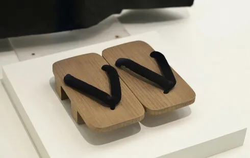
The Tabi: From Japanese Tradition to a Fashion Icon
Section: Fashion
Mapping an archaeological site usually take years to complete, but not anymore
Researchers have invented "SUAVe" - an acronym for Semi-autonomous Unmanned Aerial Vehicle, which is a flying wonder that can do all the mapping work in just a few minutes. The new system is now being tested in Peru at an abandoned colonial era town of Machu Llaqta. If all goes as planned, it could revolutionise archeology.
The project is an interdisciplinary collaboration between Vanderbilt archaeologist Dr. Steven Wernke and engineering professor Julie A. Adams from the USA. "You will unpack it, specify the area that you need it to cover and then launch it," Dr. Wernke said. "When it completes capturing the images, it lands and the images are downloaded, matched into a large mosaic, and transformed into a map."
Dr. Wernke added, "The SUAVe system could be a way to create a digital archival registry of archaeological sites before it's too late." In addition, there might be other applications for this system, such as tracking the progress of global warming and assessing the situation at disaster sites.
For more information, visit: http://www.lrz.de/services/compute/supermuc/

Section: Fashion

Section: Politics

Section: News

Section: News

Section: News

Section: Arts

Section: Fashion

Section: News

Section: News

Section: News
Health Insurance in Germany is compulsory and sometimes complicated, not to mention expensive. As an expat, you are required to navigate this landscape within weeks of arriving, so check our FAQ on PKV. For our guide on resources and access to agents who can give you a competitive quote, try our PKV Cost comparison tool.
Germany is famous for its medical expertise and extensive number of hospitals and clinics. See this comprehensive directory of hospitals and clinics across the country, complete with links to their websites, addresses, contact info, and specializations/services.
Join us at the Kunstraum in der Au for the exhibition titled ,,Ereignis: Erzählung" by Christoph Scheuerecker, focusing on the captivating world of bees. This exhibition invites visitors to explore the intricate relationship between bees and their environment through various artistic expressions,...


No comments yet. Be the first to comment!